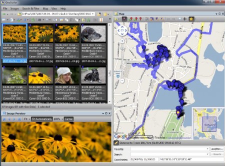
I had 7000 photos after paddling Basel – Black Sea.
3000 of them had now location or GPS information. I had forgot where I took them.
I wanted to share and document where I took them, (and I had a GPS tracker on – and in my pocket on the trip.. )
Sounds familiar?
You did not have a GPS track?
It can be solved…
The solution of it all is www.geosetter.de – and I really hope you try it.
When happy, I really hope you donate some euros to the brilliant German gentleman who made this..
What is it?:
Shows existing geo coordinates, image directions and tracks on embedded Google Maps map (requires internet connection)
Setting geo data by using embedded Google Maps map (requires internet connection) or by entering known values for coordinates and altitude directly
Automatic filling of location IPTC fields and altitude values (requires internet connection
more via GeoSetter.
