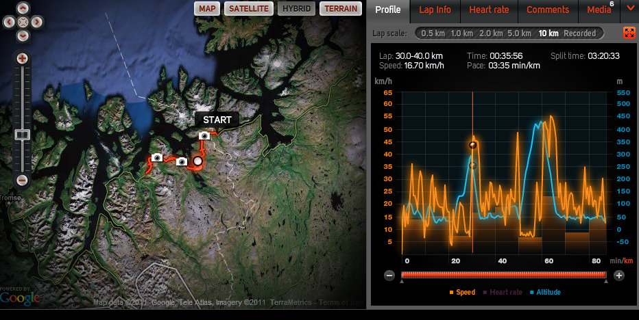
I have a lot of nice cycle tracks that you can use in your own planning.
Norway:
I have tracked 100% from Nordkapp (71 degree north of Norway) all the way down to Lindesnes (the very south) and back to Mysen. That’s 3300 KM.
35 country’s between Norway and South Africa:
I did not track but have place-tagged the coolest, best, nicest, prettiest, cheapest, or most scary places. I’m sharing those with partners.
You can use my GPS-tracks (for private- and not commercial use) and I have over 250 different tracks and information about; length, altitude, speed, how steep, how flat, and the stuff you’d like to know before a trip and planning a trip.
I also have some fine tracks with kayak, snowshoes, running, and hiking tracks – and ten tracks to nice Pub’s… 😉
– aslo all with speed, elevation, the track – and the other stuff you like to know before starting.
– the tracks is here and I hope you share yours GPS paths by sending a link to my Twitter; @heidenstrom or share it here on the site (submit the contact form)
The GPS tagged photos is here (same same but no lines and different… 😉 )
My map over the 3300 km cycle tour 2011:
(it’s been clicked on 12.000 times – so it look like maps can be used… )
Vis Norge på langs The Shirt 2011 i et større kart
Bjorn @heidenstrom on Twitter
